Raphaël Fuhrer
Time and Place: Thursday, 01.07., 16:00–17:00, Room 2
Session: Poster Session – Networks and Spatial Analysis II
Keywords: hGIS; Reconstruction of historical transport networks; Infrastructure follows infrastructure; Historical travel times; Historical transport and post maps
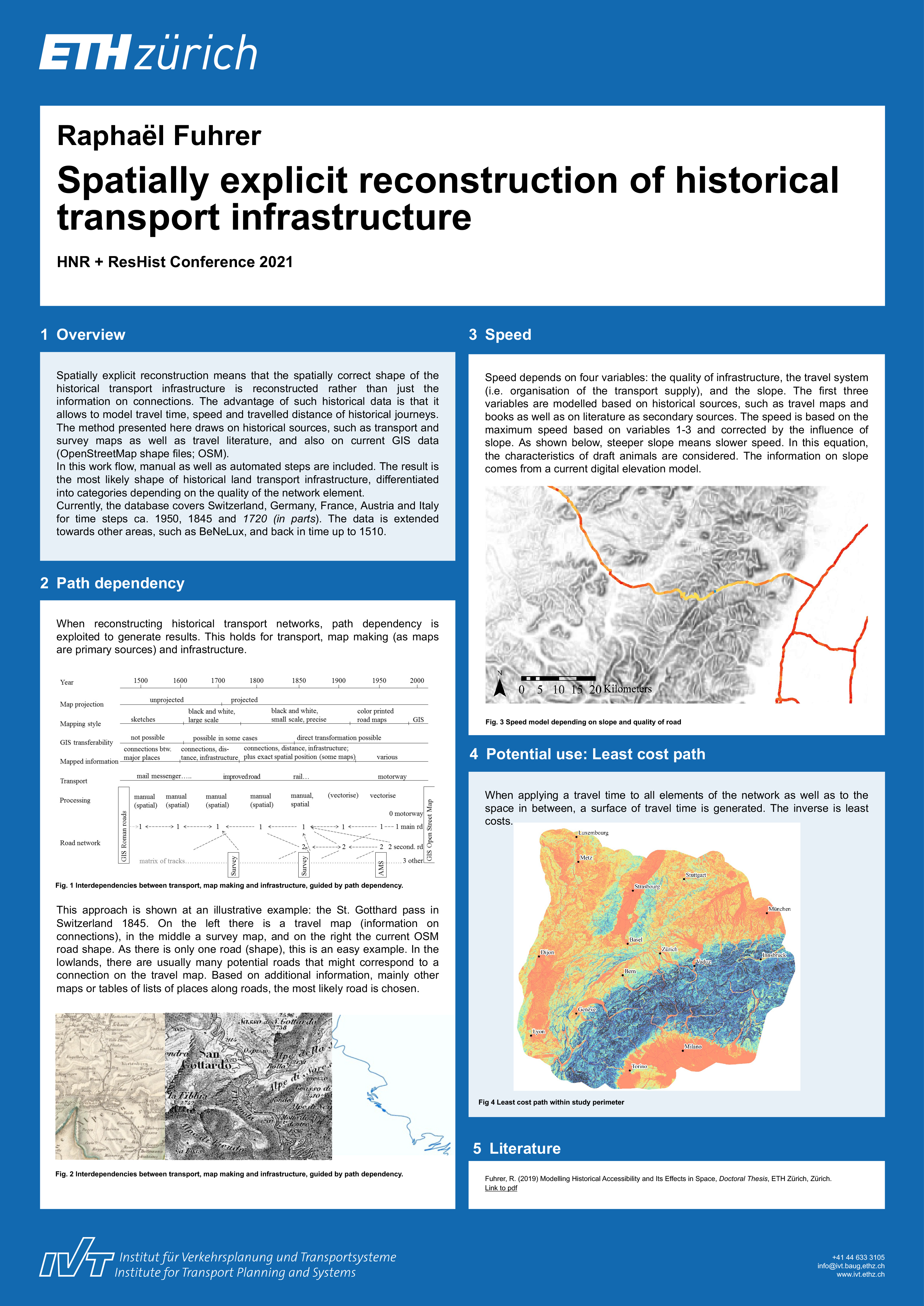
The aim of this research is to calculate and model historical accessibility in Western Europe back to 1500 in several time steps. The focus is on reconstructing historical road networks, exploiting path-dependency. The definition of accessibility is the number of points of interest at a location (for example population in a municipality) weighted by the costs to reach the location – travel time is used to express costs. This means, an estimation of travel speed between different points in space at a given time in the past is needed to calculate travel-time-based accessibility. This information is based on a time-space model of historical travel times, which are estimated based on (first) digitised networks from historical post and travel maps, (second) on a digital elevation model, (third) on information on historical transport means and travel speeds from literature. This contribution will briefly show the method of spatially exact reconstruction of historical transport networks and also cover the modelling part of historical travel time, least cost path, and subsequently accessibility. Feasibility of this approach is shown for central Western Europe back to 1730. Accessibility improvement is generally connected to increased productivity and urbanisation.