Lucas Rappo
Time and Place: Thursday, 01.07., 16:00–17:00, Room 2
Session: Poster session – Networks and Spatial Analysis II
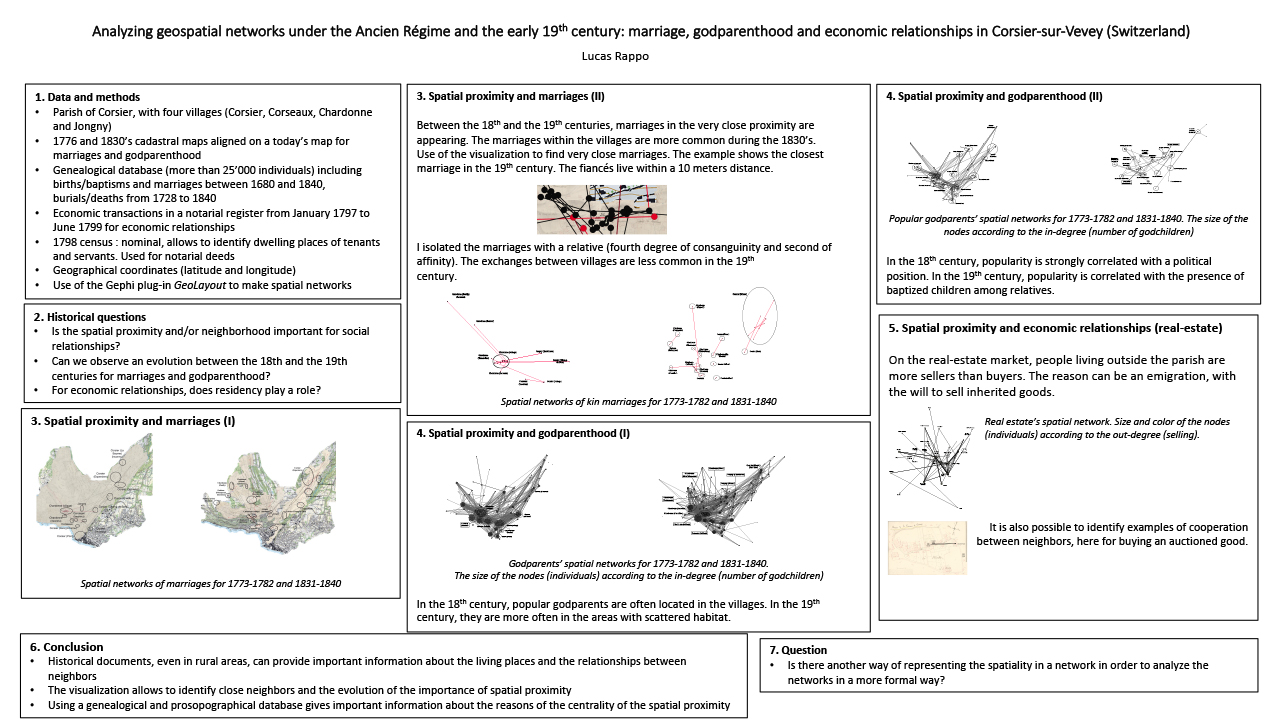
Identifying the place of residence under the Ancien Régime and in the early 19th century can be difficult for historians. Indeed, in the rural areas of Europe, there is no systematic mention of addresses or houses. This paper offers two methods for localising the dwelling houses of the inhabitants, plus it shows how to analyse the relationships between them.
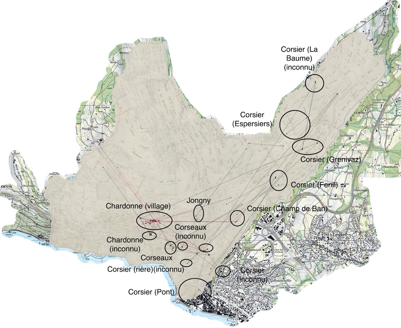
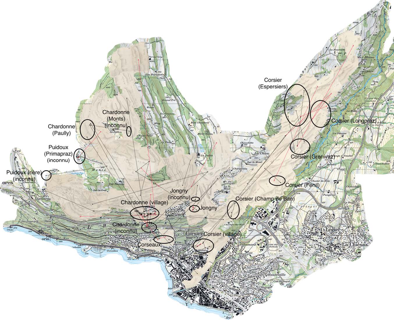
The research area is the Swiss parish of Corsier-sur-Vevey, located in the Pays de Vaud, in a vinicultural region on the shores of the Lake of Geneva. Four villages form the parish, what permitsto observe relationships inside the parish. Actually, the inner network dynamics of the matrimonial market, the godparenthood and economic relationships are not well studied, with some exceptions (Gourdon 2005; Gourdon et Robin 2017; Tassin 2007). Most of the time, the opposition between people living in the parish and the ones living outside constitutes the analytical framework, less attention being payed to the inner dynamics. The main question to
address is the importance of spatial proximity for these relationships: do we choose a godparent living nearby? Do we buy a plot or a house from a neighbour?
For this purpose, two types of historical sources are used. On the one hand, the cadastral maps of 1776 and of the 1830s, which report the parish’s plots, are useful to locate the owner’s houses and are used to identify people involved in marriages and godparenthood. These maps are then placed on an actual map of the studied region in order to align the ancient buildings
with the actual ones.
On the other hand, a population census of 1798 is mobilised, which lists the inhabitants of the different villages and places of the parish, thus without addresses, simply saying that the officers go “maison à maison”. This allows us to know where not only the owners are living, but also the houses of tenants or servants mentioned in the census.
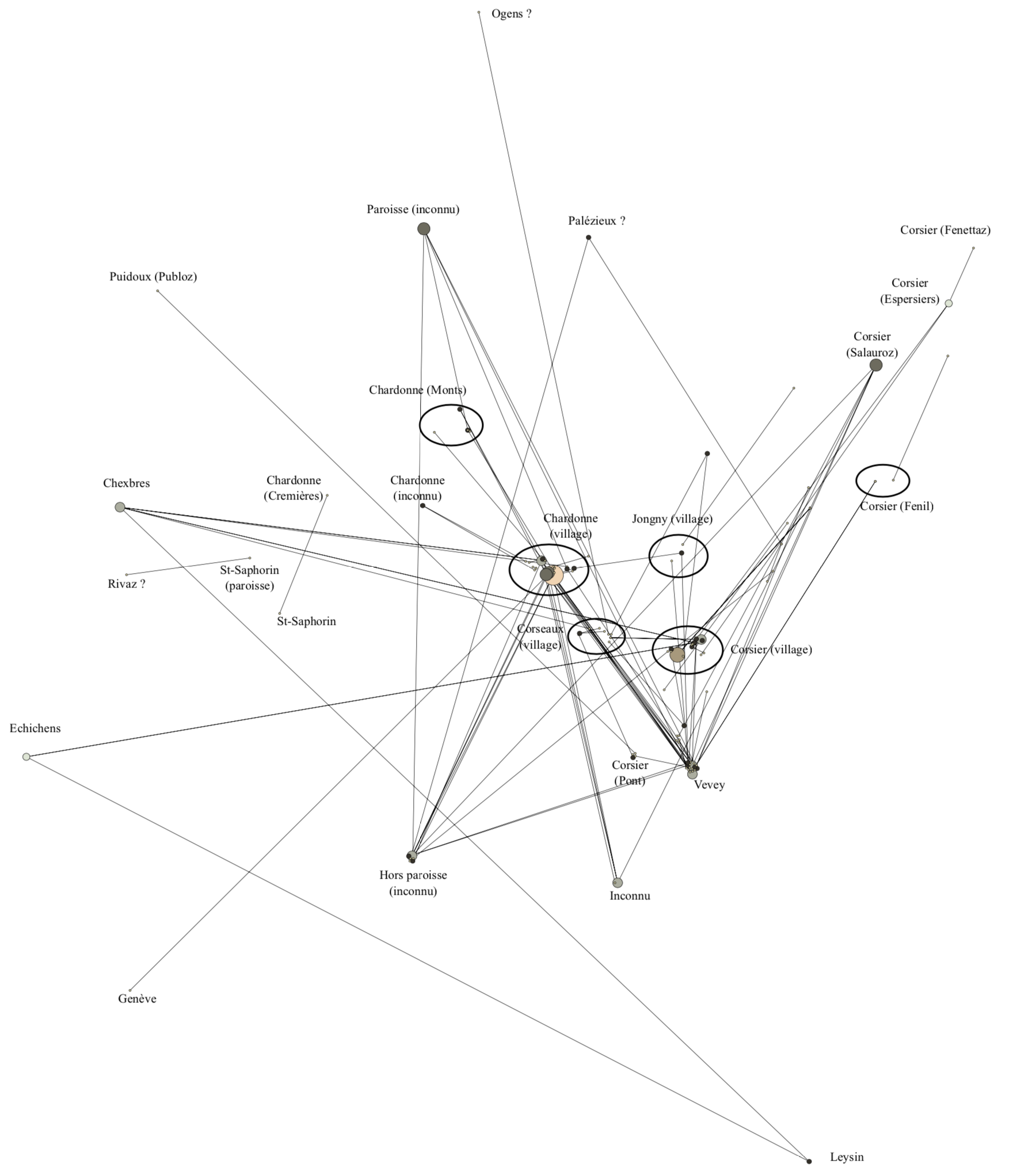
These documents are combined with a genealogical database containing the marriages, births/baptisms and deaths from 1680 to 1840, giving information about the kinship links of the people. The census of 1798 is utilised to identify the actors involved in the deeds contained in a notarial register from 1797 to 1799. The actors are then identified and localised on a map, with latitude and longitude coordinates. The GEPHI software is used to place the actors in a network visualisation using these coordinates.
These two sources are successfully used, thus with differences regarding the identification of the actors. Indeed, the maps cannot be utilised to identify all the inhabitants, where the census is more accurate to locate the tenants, servants and employees of a household. However, such a method allows to address the problem of the inner dynamics of a parish and the relationships between neighbours. Furthermore, comparing the results of the 1770’s with the 1830’s gives information about the transformation in the relationships between the Ancien Régime and the modern Switzerland.